
Waterway Navigation App Based on the Inland Ecdis Format V 2.3.
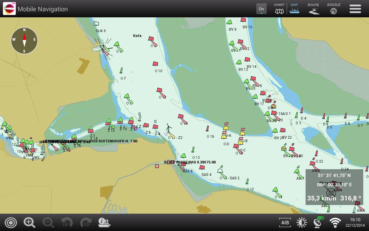
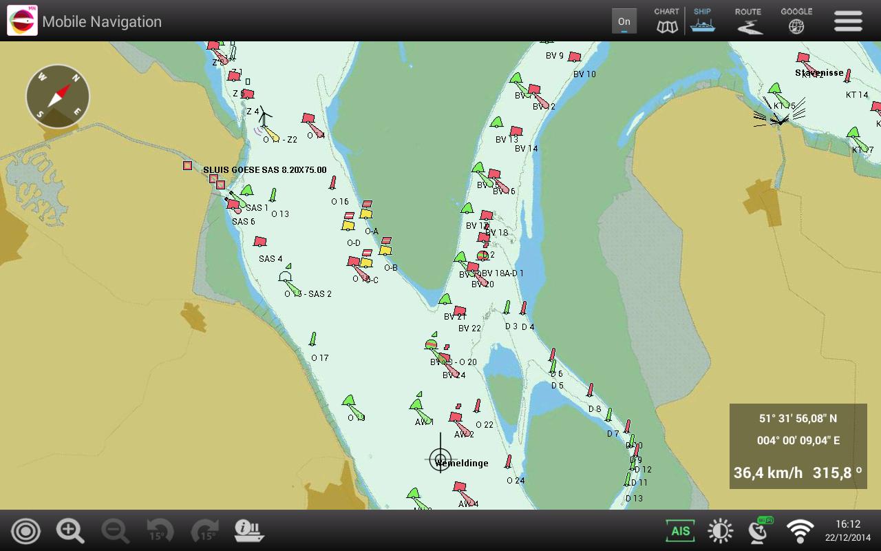
With the PC-Navigo app you can navigate on smartphone and tablet. The map material used is based on the Inland ECDIS format V 2.3, the standard in Europe for navigation on inland waterways.
All required information is available on the cards. The cards are updated on a weekly basis and are offered in a subscription formula with a certain term.
Most smartphones and tablets have a built -in GPS so that the correct position on the card can be shown immediately. GPS information can also be read in via WiFi from a network on board.
The basic functionalities for ship navigation are available and are simple, clear and well -arranged:
• Showing of detailed cards from the waterway
• Search for place names and areas
• Choice of details, text size and colors
• Zoom In / Zoom Out
• Sailing with north above or course above
• Possibility of rotating the card
• Automatic centering the ship on the map
• Display of course and speed over the ground
• Route planning via waypoints (route points)
• Display of iOS Maps as an alternative is possible
• Display of ship position via the built -in GPS
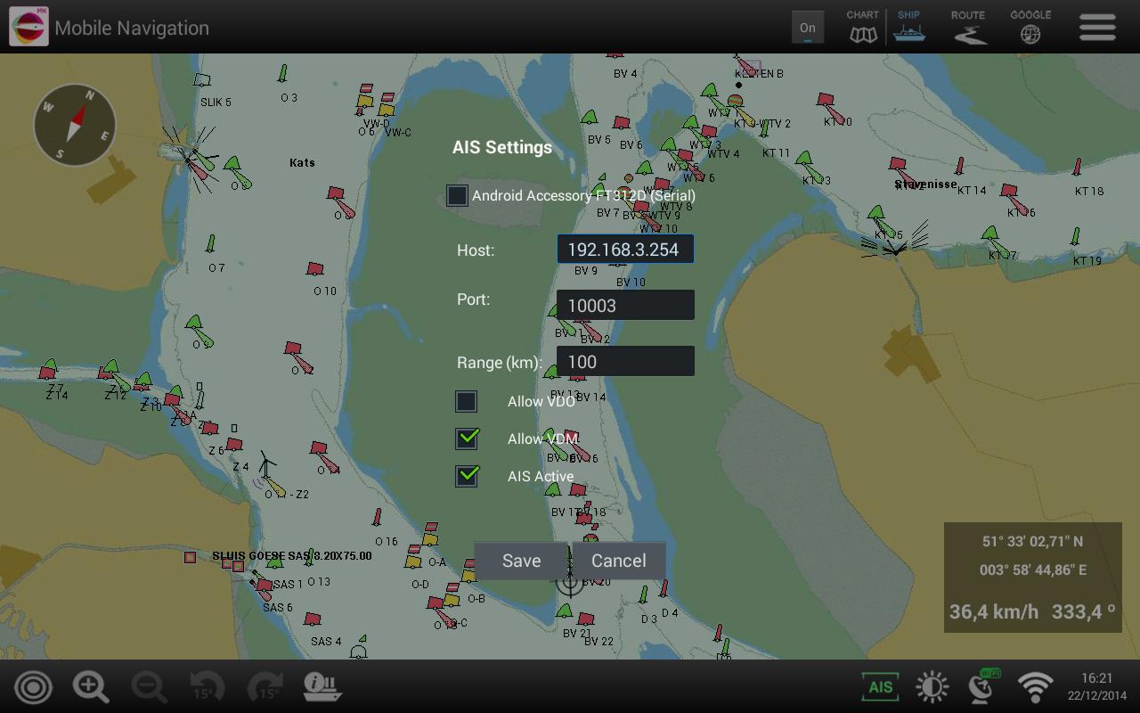
• Display of AIS information via WiFi (optional)
• Driving, programming inland AIS device via WiFi or a serial cable (optional)
July 12, 2026
July 12, 2026
July 12, 2026
July 12, 2026
July 11, 2026
July 11, 2026
July 11, 2026
July 11, 2026
July 10, 2026
July 10, 2026
 Download APK(27.43MB)